




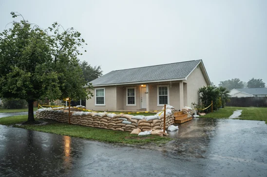
The Yavapai County Office of Emergency Management (YCOEM) is urging residents to prepare for another round of heavy rainfall, potential flash flooding, and hazardous travel conditions as multiple storm systems move into the region this weekend. With soils already saturated and waterways impacted by recent storms, additional rainfall could lead to rapid runoff, rising creeks and washes, and renewed flooding in vulnerable areas.
The National Weather Service (NWS) in Flagstaff has issued Flood Watches for Friday, October 30, from 10 a.m. to 10 p.m., and again from Saturday, October 31, at 11 p.m. through Monday, November 2, at 5 a.m. Rainfall totals of 0.5 to 1 inch are forecast Friday, with locally higher amounts up to 2 inches possible in thunderstorms. An additional 1 to 3 inches of rainfall may occur Saturday night through Sunday. Some thunderstorms Friday may also produce damaging winds exceeding 58 mph and hail.
Flash flooding is possible Friday, with a heightened flooding threat expected Sunday into Monday. The NWS is forecasting significant rises along several waterways, including Oak Creek, Wet Beaver Creek, West Clear Creek, and the Verde River. Some locations are forecast to reach minor or moderate flood stage, with the greatest impacts expected Sunday into Monday. River flooding may continue beyond Monday, even after rainfall ends.
Residents living near waterways or in flood-prone areas are encouraged to closely monitor updated forecasts and river conditions through the National Weather Service at water.noaa.gov. River forecasts are subject to change as rainfall develops and additional data becomes available.
YCOEM encourages residents to take the following precautions:





- Stay informed. Monitor weather forecasts and have multiple ways to receive emergency alerts. Register for emergency notifications at smart911.com (https://smart911.com).
- Turn Around, Don’t Drown. Never attempt to cross flooded roadways. Water can be deeper and moving faster than it appears.
- Avoid flood-prone areas. Stay away from washes, creeks, low-water crossings, swimming holes, and areas that have recently experienced flooding.
- Prepare your property. Clear drainage areas of debris, secure outdoor belongings, and consider sandbags if your property is vulnerable to flooding. Sandbag locations are available at www.YavapaiReady.gov/sandbags.
- Plan for disruptions. Keep emergency supplies accessible and prepare for possible road closures, power outages, or rapidly changing conditions.
A Flood Watch means conditions are favorable for flooding, while a Flood Warning means flooding is occurring or imminent. Residents should take warnings seriously and follow instructions from public safety officials.
With Halloween falling on Saturday, October 31, families, event organizers, and trick-or-treaters should remain weather-aware as another round of rainfall approaches Saturday night. Check conditions before heading out, avoid areas prone to flooding, and consider indoor alternatives if weather conditions become unsafe. Drivers should use extra caution, particularly in areas with reduced visibility or increased pedestrian activity.
YCOEM reminds residents that flooding can occur even where rain is not currently falling. Heavy rainfall upstream can cause waterways to rise rapidly downstream, sometimes with little warning.
Residents are encouraged to remain weather-aware throughout the weekend, avoid unnecessary travel during periods of heavy rainfall, and follow updates from the National Weather Service and local public safety agencies.
For the latest preparedness information, visit www.YavapaiReady.gov.






Ashley Ahlquist | YCOEM
Recent Articles
The Pine Ridge Prowl is Coming on October 24
New 4-way stop at Granite Street and Willis Street
Freaky Foot Tours Presents the Prescott Haunted History Tour
November Voter Publicity Pamphlet has Error in it