

Map of San Rafael Fire in Santa Cruz County
Crooks Fire
Location: 11 nautical miles south of Prescott-Bradshaw Ranger District (T12N, R2W, SEC 1), near Mt Union.
Start Date: April 18, 2022
Size: Approximately 9,402 acres


Percent Contained: 96%
Cause: Under Investigation.
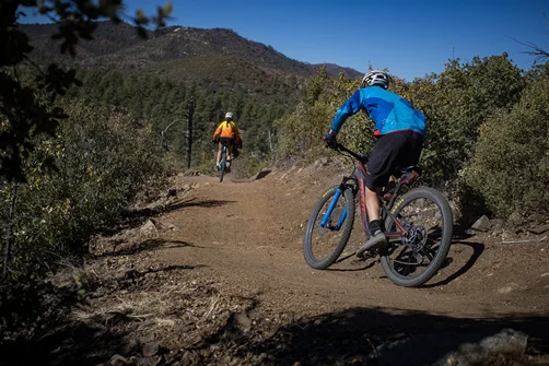
Vegetation: Timber (Litter and Understory), Chaparral (6ft)
Number of Personnel Assigned: 217
Firefighters have made progress strengthening and improving the northwest edge of the Crooks Fire, preventing growth during critical fire weather. Crews and heavy equipment will continue to patrol the fire, mop up remaining hot spots near control lines, repair and rehabilitate areas where suppression actions were taken, and clear hazardous snags and debris along roadways in and around the fire area. Light smoke may be visible at times, as interior fuels continue to burn and smolder.


Over the next few days, the Incident Management Team will begin to release resources. This process is known as right-sizing the organization. Crews will be released from the fire as objectives are met and made available to assist with other wildfires in the southwest. Remaining resources will patrol and hold the fire perimeter to ensure the fire remains within the planning area. As resources are released, the CWZ Type 3 team will begin moving the Incident Base Camp out of Watson Lake and over to Groom Creek Horse Camp on the Bradshaw Ranger District. This move could start on Tuesday, May 10 and continue through Thursday May 12, allowing the City of Prescott to re-open Watson Lake.
As a reminder, residents within the Crooks Fire area need to utilize caution while driving on the roads as firefighters continue to work in and around the fire area. The Prescott National Forest has issued a new reduced closure order which reduces the size and continues to provide for public and firefighter safety. Hazards still exist in and around the fire area and residents living nearby should utilize care as fire-weakened trees, ash pits, and burned stump holes remain.
FIRE RESTRICTIONS: Fire restrictions are used to limit certain activities on public lands during periods of extreme fire risk. Fire restrictions have various levels called stages. Each stage limits specific activities and can vary from place to place, even those areas in close proximity. Know before you go on that trip to visit our national forests or public lands. Check on current fire restrictions at: WildlandFire.az.gov
WEATHER: Sunny, dry and breezy conditions are expected to continue through midweek. A weather system will rapidly increase south-southwest winds on Wednesday before winds shift to northwest Wednesday evening. Drier and less windy conditions will return later this week.
FOREST CLOSURE: The Prescott National Forest has reduced the fire area emergency closure allowing for Upper Goldwater Lake and portions of the Circle Trail to re-open to the public. The closure provides public health and safety due to firefighting operations on the Crooks Fire. Prescott National Forest Fire Closure Order and Fire Closure Map
Temporary Flight Restriction (TFR) is in place: Wildfires are a NO Drone Zone. Flying recreational and media drones within a TFR is illegal and impedes fire suppression efforts. Report drones to local law enforcement. If you Fly, We Can’t.
*******
San Rafael Fire Update


Start date – Saturday, May 7, 2022
Size – 10,562 acres
Containment – 0%
Location – 22 miles SE of Patagonia
Cause– Under Investigation
Crews took advantage of the decreased fire activity overnight and conducted fire handline construction ahead of the fire as a way to help slow the fire’s forward progress. This is a tactic used to reduce fuel in an area to potentially limit fire spread and growth. However, another round of Red Flag conditions Monday may hinder daytime fire suppression efforts as high winds, low relative humidity, and a dry fuel bed can create fast fire spread and erratic fire behavior, and likely unsafe fire conditions for direct suppression efforts. Predicted winds out of the southwest again can push the fire further to the north and northeast.
Additional resources arrived on the fire Monday morning, including hand crews and engines. Nearly 120 personnel are assigned to the fire. Aircraft, including Large Air Tankers (LATs), Very Large Air Tankers (VLATs), and helicopters are also assigned, but high winds may limit the ability to use aircraft efficiently.
On Sunday, the wind-driven fire pushed to the northeast twelve miles through a very dry grass crop. The fire was mapped Monday morning at 10,562 acres with no containment. The Santa Cruz County Sheriff’s Office reports SET for residents northeast of State Route 83 and Forest Road 799. The area south of State Route 83, in the area of Canelo Pass Road and Forest Road 799, remains in GO. Approximately 80 people have been evacuated due to the fire. Trigger points are used by fire management to determine when to notify residents of a possible evacuation based on current and expected fire behavior. But as with any wildfire incident, conditions can change quickly and residents are urged to stay alert and be mindful of their surroundings. The Red Cross has set up a shelter for evacuees at the United Methodist Community Church, 387 McKeown Avenue, in Patagonia. Currently, State Route 83 is open, but road conditions can also change at any given time. Drivers are urged to check 5-1-1. On Saturday, May 7, 2022, around 6:30 pm, the Department of Forestry and Fire Management, along with federal and local cooperators responded to the San Rafael Fire, approximately 22 miles southeast of Patagonia, in the San Rafael State Natural Area. The fire is under investigation