

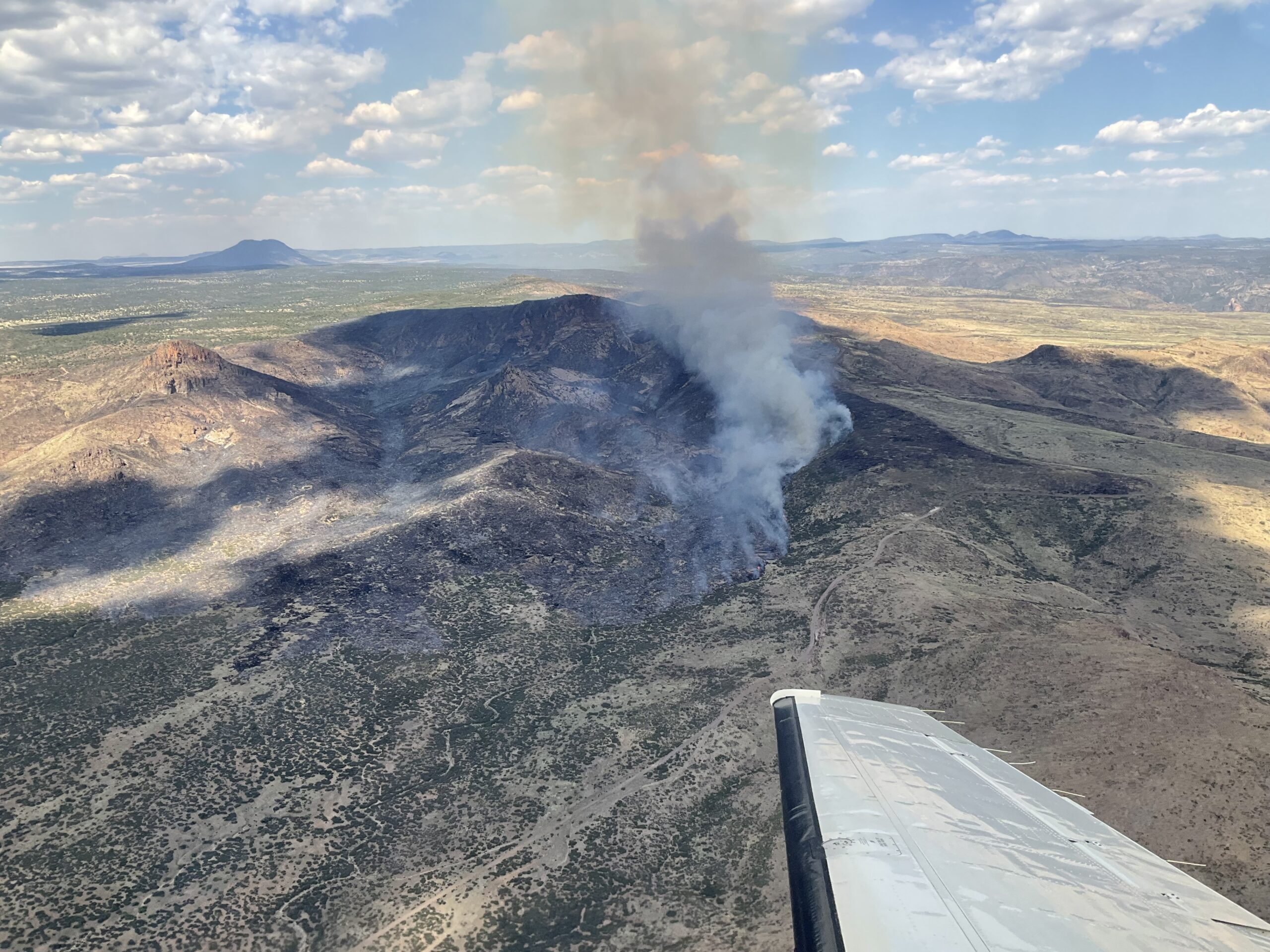
Photo: Air Attack on Pilot Fire
Start Date: 07/01/2023
Location: 20 mi. E. Wikieup on the O RO Ranch within the Mohon Mountains, Yavapai County
Cause: Human-caused, unknown at this time
Acres: 33,834 Containment: 39%
Evacuations: None; Structures Damaged: 0 Destroyed: 0
The fire stayed within its footprint again Wednesday with some heat still remaining on the eastern flank and within Mohon Peak. Crews have secured line around much of the fire and established additional black line today on the northwest side. The fire is now 39% contained. Resources also conducted some proactive fuels reduction work around structures and infrastructure on the northeast and southwest flanks of the fire. The plan over the next few days is to continue strengthening the line in some areas, including along the east side near SH Butte. Crews will also monitor and cold trail the lines over the next few days to ensure there is no remaining heat along the perimeter. Along with hand crew work, the use of natural fire barriers, previous burn scars, and natural monsoon activity play a role in fire suppression efforts.
Hotshot crews, hand crews, engines, aircraft, and medic teams are supporting the incident. Approximately 154 personnel are assigned to the fire.


The human-caused Pilot Fire started Saturday, July 1, around 11 am and is located near the O RO Ranch within the Mohon Mountains in Yavapai County, approximately 20 miles east of the town of Wikieup. The fire is burning in an area that has very substantial fire history, within rugged and remote terrain in a sparsely populated area. The terrain-driven fire made a run up Pilot Knob on Saturday and produced a highly visible smoke column noticeable to residents as far away as Kingman.
Weather: Seasonally hot temperatures with increasing RH and moderate winds.
Incident Information:
InciWeb
Twitter: @azstateforestry
Facebook